On Sunday 29th September, after months of anticipation, I climbed aboard a British Airways 777 at Heathrow, bound for Tokyo’s Haneda airport. J and I had been planning this trip for months and I was perhaps as excited about the journey as the destination. All the air miles that I had accumulated while travelling for work between 2009 and 2011 were exchanged for return tickets in First Class, a treat we would never ordinarily have afforded.
Our three weeks in Japan passed all too quickly and I can’t hope to recount all of our amazing experiences there in one blog post. While our itinerary (mostly completed via the magnificent Shinkansen bullet trains) took us to Hiroshima, Kyoto, Osaka and back to Tokyo, in this post I will concentrate on our time in Miyajima in the south, and the Alps region in Honshu, where we sampled the delights of mountain walking, Japan style.
Miyajima
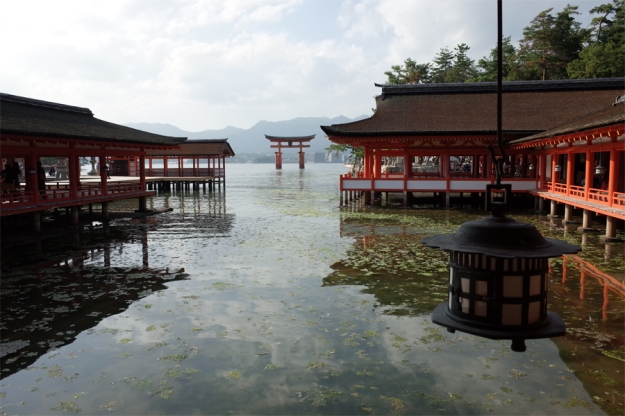
Miyajima
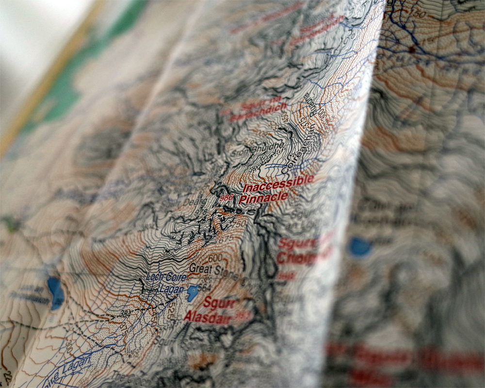
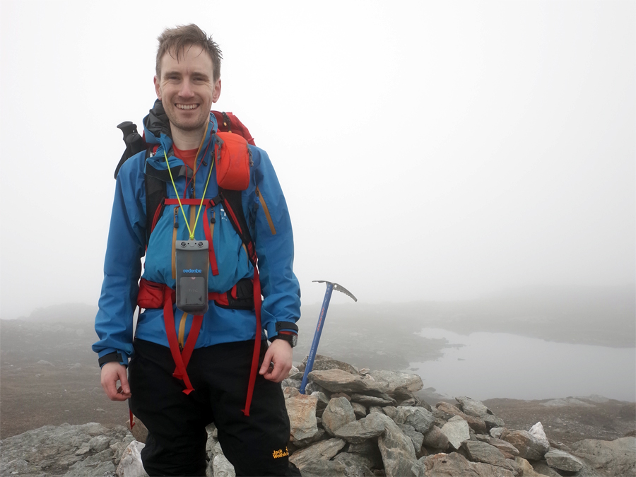
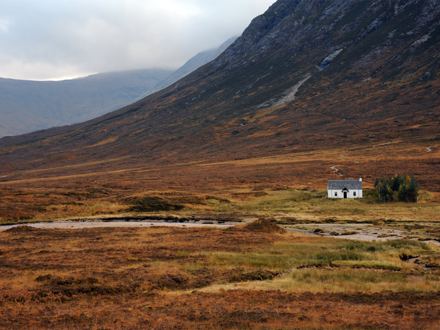
Miyajima is a tiny, hilly island just off the coast near Hiroshima. It is a lovely spot to overnight in a traditional Japanese ryokan, a lodging where zen and comfort combine. Famous for its Tori shrine, while on the island we also took the opportunity to climb to its summit, Mount Misen (535m) to enjoy spectacular views of the coast around. The trails up and down were well marked and though the mountain is not particularly high, it is a steep climb from sea level and the rocky summit has the feel of a ‘proper’ mountain. It had been a few weeks since my fairly testing round of four of the Crianlarich munros and it was reassuring to zip up and down Misen with my legs feeling strong. I had not been able to pack hiking poles in my luggage and I have come to depend on them quite a bit on my trips to Wales and Scotland. The fact that I could climb comfortably without them for a day is witness to the strength I feel I have developed, compared to my first, fairly painful forays into the world of mountain walking in 2012.
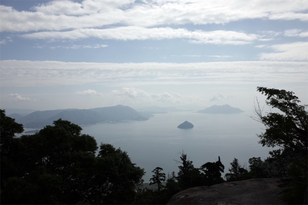
Misen summit view
From Takayama to the Alps
After an unforgettable week in Kyoto and Osaka we continued northwards to Takayama. A small, peaceful city in stark contrast to the mayhem of Tokyo and Osaka, Takayama sits at around 570m above sea level. It was from here that I caught my first glimpse of the high peaks of the Alps, towering over 3000m on the horizon. Soon we could see the mountains even more clearly, as a bus carried us towards the resort of Kamikochi. With private cars prohibited in the resort centre, buses are the only means of transport in or out. As we crept through a tunnel burrowed several kilometres inside an enormous mountain, along immaculately maintained tarmac, I was reminded of my rather bumpier trips along the A82 from Glasgow to Crianlarich this year. I wonder if the Japanese could spare a few of their road engineers to sort out that mess at Pulpit Rock? While they’re over, perhaps they could fix us up with some nice new trains too?
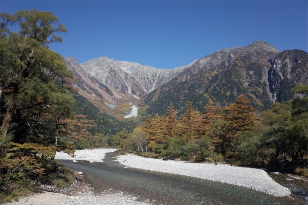
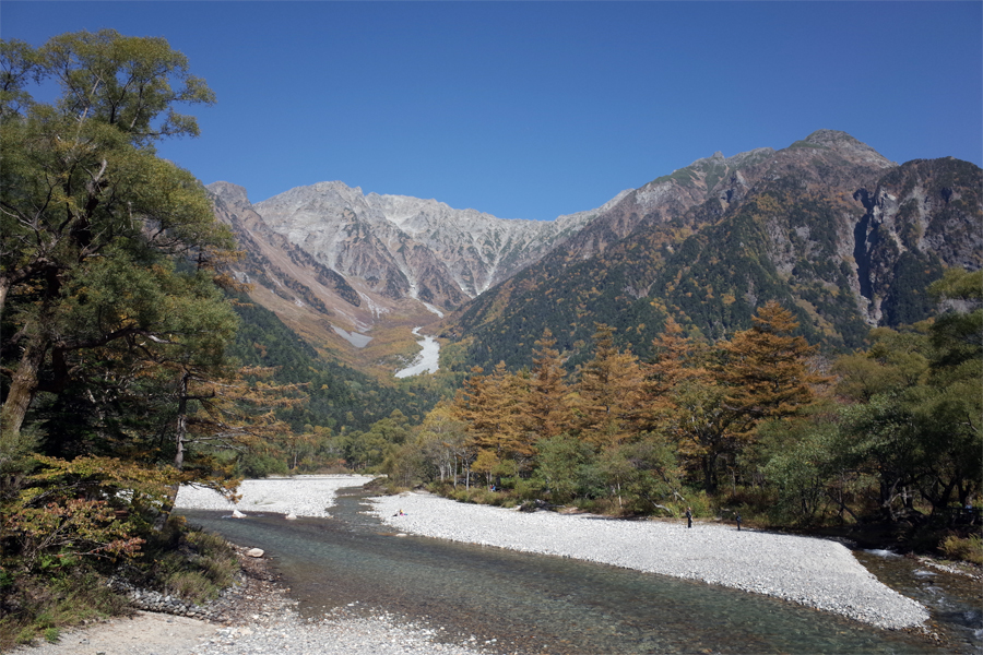
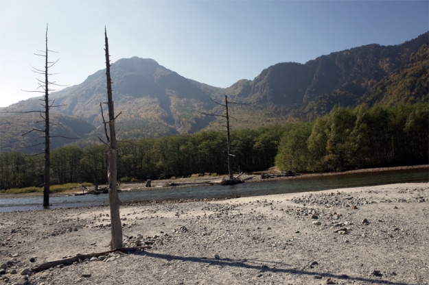
Kamikochi
In Kamikochi we stayed at a guest house run by an experienced Japanese mountaineer. The lodging had a fantastic library of mountain literature, and photographs on the wall of Mr Okada’s expeditions in the Himalayas, including K2 and Everest. On the first afternoon we enjoyed a pleasant stroll along good paths to explore the valley itself, with magnificent mountains all around us. Until dusk the trails were very busy. Accommodation in Kamikochi itself is limited, and most visitors jump on a bus at the end of the day, to return to Matsumoto or nearby Hirayu Onsen. The autumn weather was perfect and we had a good look at our objective for the next day – Yake Dake, an active volcano climbing to 2455m above sea level.
Yake Dake (2455m)
Luckily, the good weather held and early the next morning we set out on the trail, passing the ‘Weston Memorial’ – a small dedication to Walter Weston, an English missionary who is widely credited as one of the pioneers of mountaineering in Japan. Notwithstanding the good weather, we set out into the cold, clear dawn still with some trepidation. A couple of weeks earlier, the very day we had left for Japan, there had been a terrible disaster on another nearby volcano, Mount Ontake, where an eruption of steam and water had claimed 57 lives. From what we had read and heard, the phreatic type of eruption that had occurred is extremely difficult for seismologists to predict. The evening before our attempt on Yake Dake, I had asked Mr Okada whether he considered the popular route to be a dangerous proposition, in the wake of recent events. His answer was straightforward, “Of course it is dangerous. It is a mountain. But people climb it all the time and the trail is clear. I expect you will be fine.” Can’t argue with that, all mountains are potentially dangerous, volcano or not.
The first part of the climb takes you through quite dense forest. It takes a reasonable amount of time to get above the tree line. This frustrated me a little. One of the great things about any mountain day in Britain (or anywhere else as far or further north) is the speed with which you get above the trees and (on a clear day) are rewarded with views. Another odd thought that struck me was that our hike today would begin an end on a valley floor that already sits about 100m higher than the summit of Ben Nevis. Indeed, while today’s route would take me to the highest summit I have ever reached under my own steam (cable cars to 2000m in Austria and motor cars to 3000m in Armenia don’t count!) the day would only involve around 950m of vertical ascent, something I ought to manage easily enough after a year of intense munro bagging.

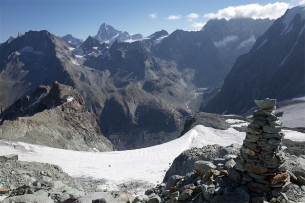
At the col
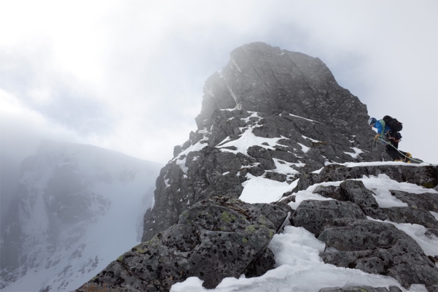
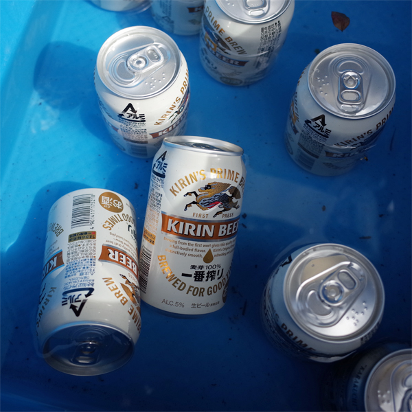
As we crept above the trees we encountered a steep section whose ascent is facilitated by long, almost vertical fixed ladders. I had mixed feelings about these. On the one hand, it is great that they open the way to everyone – and the route was certainly busy. But they do spoil the natural environment somewhat. Ultimately I had to be thankful for them because I am no rock climber and, I suspect, without them, would not have been able to continue. After the next section we reached a col that was a natural resting spot. Here we were surprised to find a small hut selling refreshments, including cold beer sitting in a bucket of melting ice! I found this very strange – beer at 2000m in between steep ladders and a rocky scramble to a volcanic summit. Maybe not the best idea.

One of these
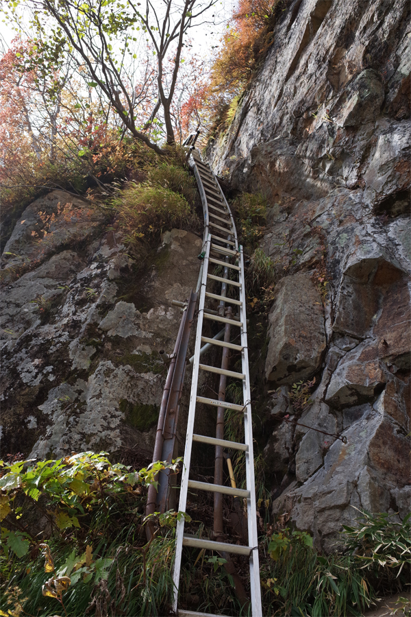
Followed by one of these?
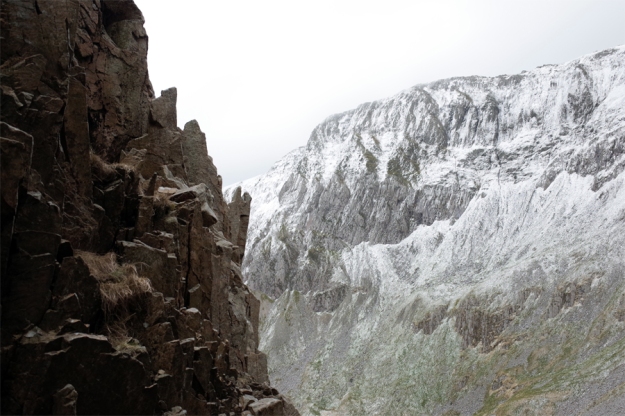
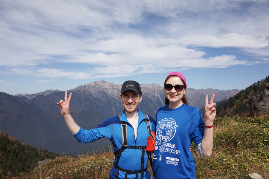
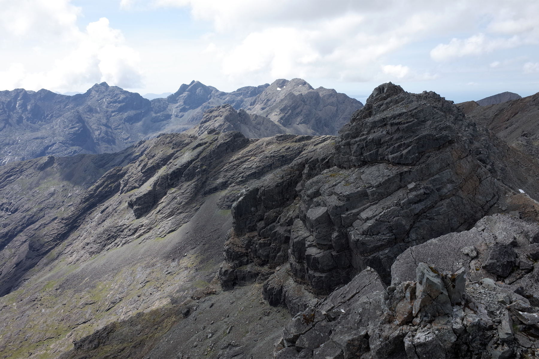
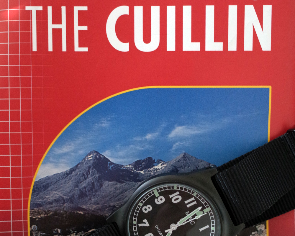
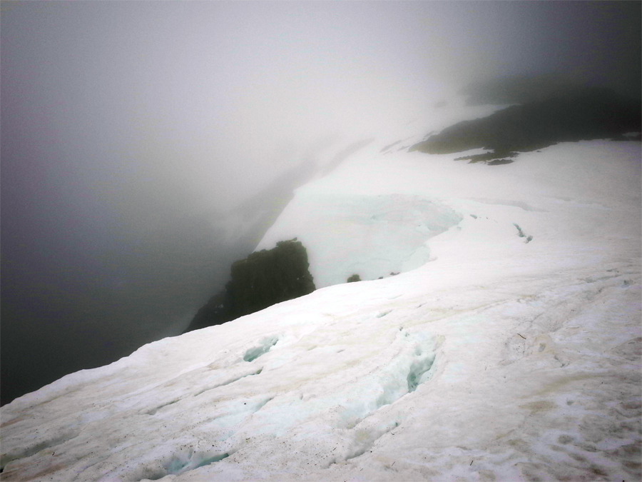
Departing the col we enjoyed simply spectacular views all around. My heart was really stirred by the sight of these enormous mountains. Looking at the way ahead I was excited to think how high we were about to climb. As we neared the summit evidence of volcanic activity was all around us; fluorescent sulphur deposits on the rock, steam venting from cracks in the mountainside and the powerful odour of rotting eggs. It’s fair to say that by this stage of the day I was enjoying things rather more than J was. After all the fun I had had on the Cuillin and the Glyders earlier in the year, this was just the icing on the cake for me – an unforgettable and awe inspiring mountain environment in a strange but wonderful foreign land. While I felt in my element, I think for J the sensations were less pleasant. While she enjoys hill walking (and we have walked together in Wales and the Lakes) this terrain was harder, rockier and less forgiving than anything she had experienced before. She certainly felt exposed and was fearful of a slip. Little good it did me to try to reassure her that the trail was really very good and the exposure really minimal, even compared with a ridge like Crib Goch, let alone the Cuillin.
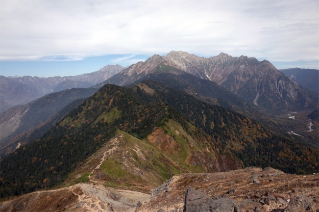
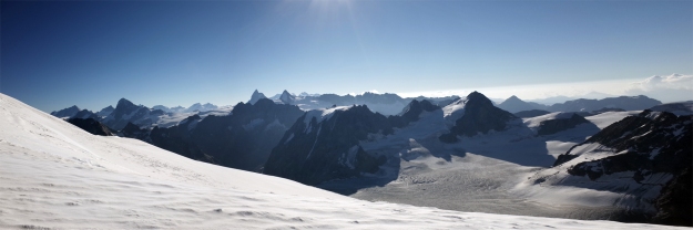
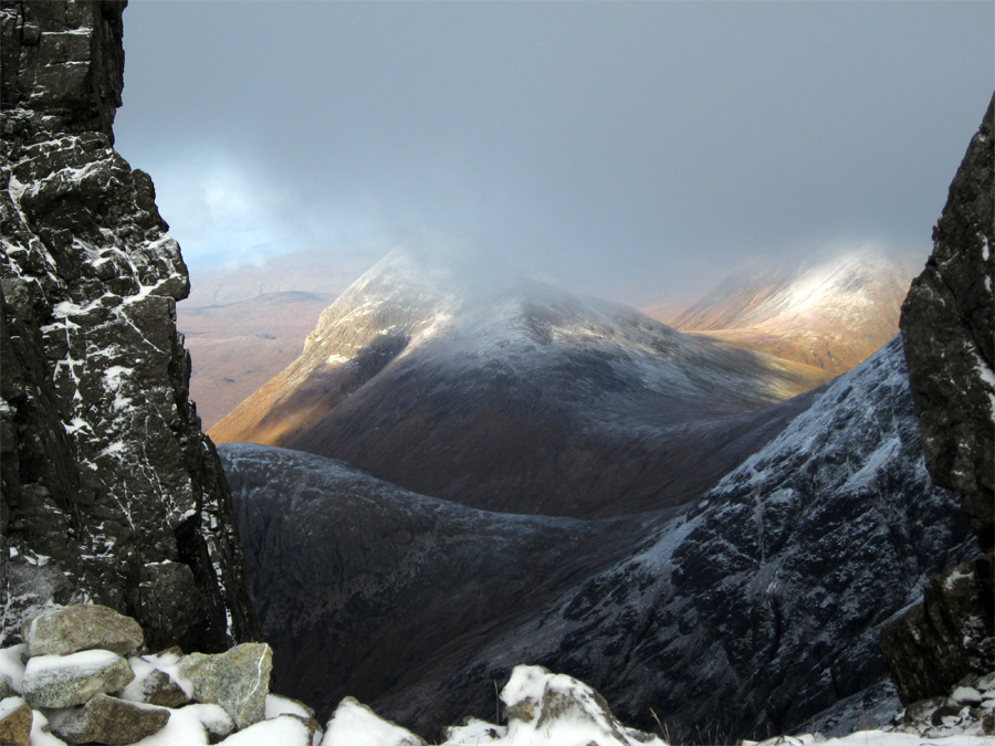
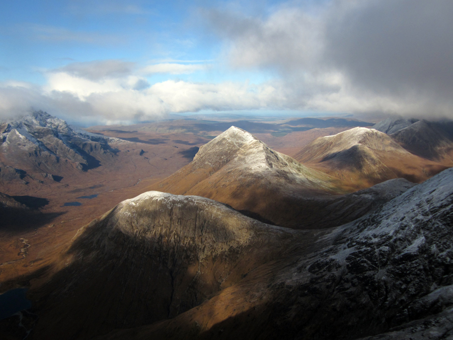
Japan Alps
Reaching the south summit (around 2400m) we did not stay long. The route to the true summit (at 2455m) is not passable without technical climbing. We took photos and headed off. As much as I was enjoying the sensational views, the image of hikers running from the ash cloud on Ontake was at the front of my mind, and I knew J was eager just to get down. After navigating the ladders in reverse we stopped again at the little hut to have our snack bar lunch and drink some water – I resisted the temptation to grab a beer! Before too long we were back below the trees. We passed dozens of other hikers making their way up. I almost ran out of breath uttering “konichiwa” and offering a slight bow to everyone we passed. These frequent encounters and busy trails stand in contrast to some of the quieter mountain days I’ve had this year in Wales and Scotland. At the valley floor we also ran across a few monkeys – quite different from the wildlife in Glencoe!
That evening, I retired to my bed (well, my Japanese bedding laid atop tatami mats on the floor of our zen room) with that very pleasant feeling of tiredness that only a good day in the mountains can deliver. The next morning I was relieved at the hard rain pouring down outside but spared a thought for those who would climb today. Our luck with the weather could not have been better. Before leaving I chatted briefly with Mr Okada about the mountains of the UK. He was aware of the famous climbs on Ben Nevis and mentioned that Tower Ridge looked like a superb winter climb. He showed me photos of some of the winter climbing on the northern island of Hokkaido which looked fantastic. By the end of the day, after a bus ride to Nagoya, a local train to Tokyo’s Shinjuku station and the tastiest railway lunch box you can imagine, we were back in the mega metropolis where our exploration of Japan had begun a couple of weeks before.
Our trip to Japan really was the trip of a lifetime. The climbs of Misen and Yake Dake are etched just as firmly in the memory as our days among the splendid shrines and temples of Kyoto and the awesome energy of Tokyo and Osaka. I would certainly love one day to return to Japan and see more of the country and its mountains. More of my photographs from this trip are at my flickr.